This project seeks to build the capacities of conservation groups in the use of GIS and remote sensing in conservation planning. It tries to address the lack of capacities in conservation groups by conducting four five day workshops, one in each of the states of Maharashtra, Karnataka, Kerala and Tamil Nadu. Potential partners from Goa will be invited to workshops held at venues nearby.
The goal of the project is to build capacities of conservation groups in the Western Ghats in the use of spatial technologies. Its objectives are:
1) To train them in the use of GIS, GPS and remote sensing applications for conservation planning using open source tools and technologies.
2) To introduce spatial statistics and landscape ecology applications which can be built upon further by these institutions for their conservation agendas.
3) To build a list of GIS-enabled resource persons who will provide local support for GIS/RS.
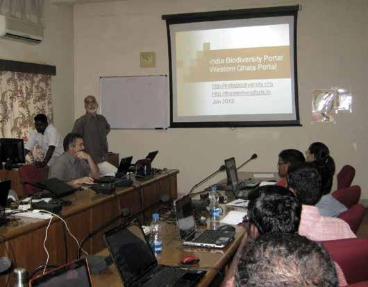
The project has trained over a hundred researchers active in the field of conservation and ecology in the Western Ghats in the use of spatially explicit tools. The workshops themselves were hosted by five different institutions thereby helping in networking them and creating a group of resource persons.
The training has filled an important gap in the capacities of these researchers to use spatially explicit data from a variety of sources in conservation related research.
The project has helped bring together an initial set of syllabi for teaching spatial analysis to ecologists based on discussions with experts in the field. This may have long term impacts on the quality of research outputs from institutions involved in these fields.
The project has exceeded the targets set in terms of numbers of students and institutions covered as well as the range of topics that were taught and discussed.
1. Over a 100 persons from conservation groups were trained in the use of open source software for GIS, GPS, remote sensing and introduced to spatial statistics and landscape ecology applications.
2. Online resources for the training in terms of tutorials, quizzes, reading materials and exercises were provided via an internet based course management software.
3. Free and open source software for spatial applications were installed and configured for each of the participants on their computers.