This project seeks to develop a comprehensive planning, monitoring and assessment tool for the Depart- ment of Water Resources, Madhya Pradesh Govt.’s pilot project on participatory irrigation management supported by the India Canada Environment Facility. The workshops will combine participatory techniques with computer mapping and electronic data storage.
The overall goal of the project is to set up a in-house spatial decision support system for MP-PIM project supported by ICEF. This will improve the planning, monitoring, assessment and thus the implementation of the Madhya Pradesh Participatory Irrigation Management Project through appropriate use of informa- tion technology, particularly spatial decision support systems.
The specific objectives are:
- To build capacities of WUAs, partner NGOs and the officer in the use of basic software for office applications.
- To build capacities of Water User Associations and facilitating agencies in the use of participatory tools with GIS and RDMS as a framework for data storage, retrieval and analysis.
- To build capacities of the facilitation agencies in the use of vector GIS and related software
- To prepare training modules comprising booklets and CDs with working examples and exercises on each of the above.
- To build a working spatial decision support system through hands on pilot projects using the above that will generate standard as well as custom reports. In this process the project will demonstrate a low cost model for implementing agencies to utilise IT for planning, monitoring and assessments of community based natural resource based projects.
Over its one year period, the project will built skills of stake holders through hands on workshops covering:
- Basic office software.
- Computer based mapping and PRAs.
- Design of a system for decision support based on spatial information and data.
- Usage of the system for planning, monitoring, reporting and assessments.
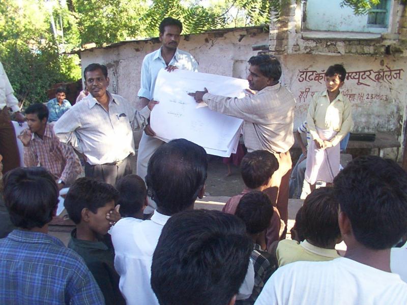
Many of the participants in the workshops were first time computer users, this included farmers who were members of water users associations. Other participants were engineers and development professionals working in local NGOs.