Error message
- Deprecated function: array_key_exists(): Using array_key_exists() on objects is deprecated. Use isset() or property_exists() instead in Drupal\Core\Controller\ControllerResolver->doGetArguments() (line 139 of core/lib/Drupal/Core/Controller/ControllerResolver.php).
- Deprecated function: array_key_exists(): Using array_key_exists() on objects is deprecated. Use isset() or property_exists() instead in Drupal\Core\Controller\ControllerResolver->doGetArguments() (line 139 of core/lib/Drupal/Core/Controller/ControllerResolver.php).
- Deprecated function: array_key_exists(): Using array_key_exists() on objects is deprecated. Use isset() or property_exists() instead in Twig_Template->getAttribute() (line 582 of vendor/twig/twig/lib/Twig/Template.php).
- Deprecated function: array_key_exists(): Using array_key_exists() on objects is deprecated. Use isset() or property_exists() instead in Twig_Template->getAttribute() (line 582 of vendor/twig/twig/lib/Twig/Template.php).
- Deprecated function: array_key_exists(): Using array_key_exists() on objects is deprecated. Use isset() or property_exists() instead in Twig_Template->getAttribute() (line 582 of vendor/twig/twig/lib/Twig/Template.php).
- Deprecated function: array_key_exists(): Using array_key_exists() on objects is deprecated. Use isset() or property_exists() instead in Twig_Template->getAttribute() (line 582 of vendor/twig/twig/lib/Twig/Template.php).
- Deprecated function: array_key_exists(): Using array_key_exists() on objects is deprecated. Use isset() or property_exists() instead in Twig_Template->getAttribute() (line 582 of vendor/twig/twig/lib/Twig/Template.php).
- Deprecated function: array_key_exists(): Using array_key_exists() on objects is deprecated. Use isset() or property_exists() instead in Twig_Template->getAttribute() (line 582 of vendor/twig/twig/lib/Twig/Template.php).
- Deprecated function: array_key_exists(): Using array_key_exists() on objects is deprecated. Use isset() or property_exists() instead in Twig_Template->getAttribute() (line 582 of vendor/twig/twig/lib/Twig/Template.php).
- Deprecated function: array_key_exists(): Using array_key_exists() on objects is deprecated. Use isset() or property_exists() instead in Twig_Template->getAttribute() (line 582 of vendor/twig/twig/lib/Twig/Template.php).
- Deprecated function: array_key_exists(): Using array_key_exists() on objects is deprecated. Use isset() or property_exists() instead in Twig_Template->getAttribute() (line 582 of vendor/twig/twig/lib/Twig/Template.php).
- Deprecated function: array_key_exists(): Using array_key_exists() on objects is deprecated. Use isset() or property_exists() instead in Twig_Template->getAttribute() (line 582 of vendor/twig/twig/lib/Twig/Template.php).
- Deprecated function: array_key_exists(): Using array_key_exists() on objects is deprecated. Use isset() or property_exists() instead in Twig_Template->getAttribute() (line 582 of vendor/twig/twig/lib/Twig/Template.php).
- Deprecated function: array_key_exists(): Using array_key_exists() on objects is deprecated. Use isset() or property_exists() instead in Twig_Template->getAttribute() (line 582 of vendor/twig/twig/lib/Twig/Template.php).
- Deprecated function: array_key_exists(): Using array_key_exists() on objects is deprecated. Use isset() or property_exists() instead in Twig_Template->getAttribute() (line 582 of vendor/twig/twig/lib/Twig/Template.php).
- Deprecated function: array_key_exists(): Using array_key_exists() on objects is deprecated. Use isset() or property_exists() instead in Twig_Template->getAttribute() (line 582 of vendor/twig/twig/lib/Twig/Template.php).
- Deprecated function: array_key_exists(): Using array_key_exists() on objects is deprecated. Use isset() or property_exists() instead in Twig_Template->getAttribute() (line 582 of vendor/twig/twig/lib/Twig/Template.php).
- Deprecated function: array_key_exists(): Using array_key_exists() on objects is deprecated. Use isset() or property_exists() instead in Twig_Template->getAttribute() (line 582 of vendor/twig/twig/lib/Twig/Template.php).
- Deprecated function: array_key_exists(): Using array_key_exists() on objects is deprecated. Use isset() or property_exists() instead in Twig_Template->getAttribute() (line 582 of vendor/twig/twig/lib/Twig/Template.php).
- Deprecated function: array_key_exists(): Using array_key_exists() on objects is deprecated. Use isset() or property_exists() instead in Twig_Template->getAttribute() (line 582 of vendor/twig/twig/lib/Twig/Template.php).
- Deprecated function: array_key_exists(): Using array_key_exists() on objects is deprecated. Use isset() or property_exists() instead in Twig_Template->getAttribute() (line 582 of vendor/twig/twig/lib/Twig/Template.php).
- Deprecated function: array_key_exists(): Using array_key_exists() on objects is deprecated. Use isset() or property_exists() instead in Twig_Template->getAttribute() (line 582 of vendor/twig/twig/lib/Twig/Template.php).
- Deprecated function: array_key_exists(): Using array_key_exists() on objects is deprecated. Use isset() or property_exists() instead in Twig_Template->getAttribute() (line 582 of vendor/twig/twig/lib/Twig/Template.php).
- Deprecated function: array_key_exists(): Using array_key_exists() on objects is deprecated. Use isset() or property_exists() instead in Twig_Template->getAttribute() (line 582 of vendor/twig/twig/lib/Twig/Template.php).
- Deprecated function: array_key_exists(): Using array_key_exists() on objects is deprecated. Use isset() or property_exists() instead in Twig_Template->getAttribute() (line 582 of vendor/twig/twig/lib/Twig/Template.php).
- Deprecated function: array_key_exists(): Using array_key_exists() on objects is deprecated. Use isset() or property_exists() instead in Twig_Template->getAttribute() (line 582 of vendor/twig/twig/lib/Twig/Template.php).
- Deprecated function: array_key_exists(): Using array_key_exists() on objects is deprecated. Use isset() or property_exists() instead in Twig_Template->getAttribute() (line 582 of vendor/twig/twig/lib/Twig/Template.php).
- Deprecated function: array_key_exists(): Using array_key_exists() on objects is deprecated. Use isset() or property_exists() instead in Twig_Template->getAttribute() (line 582 of vendor/twig/twig/lib/Twig/Template.php).
- Deprecated function: array_key_exists(): Using array_key_exists() on objects is deprecated. Use isset() or property_exists() instead in Twig_Template->getAttribute() (line 582 of vendor/twig/twig/lib/Twig/Template.php).
- Deprecated function: array_key_exists(): Using array_key_exists() on objects is deprecated. Use isset() or property_exists() instead in Twig_Template->getAttribute() (line 582 of vendor/twig/twig/lib/Twig/Template.php).
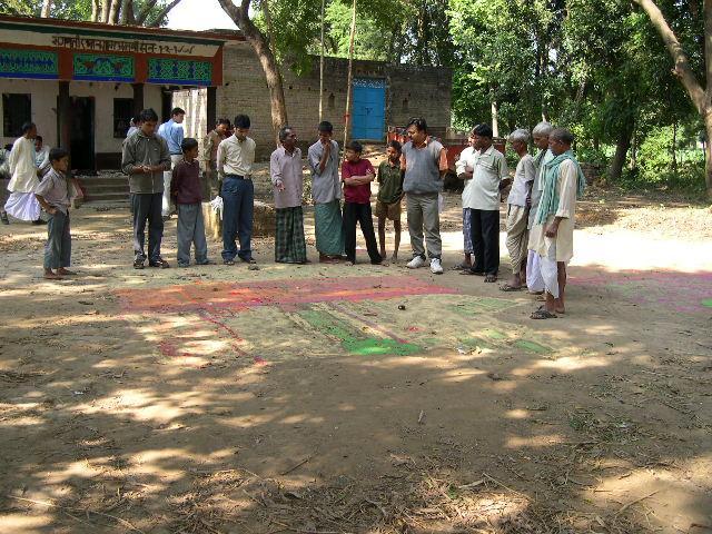
Participatory GIS training for the Indian Council for Agricultural Research/Research Complex for Eastern Regions, Patna, Bihar
Objectives
To impart training and provide relevant software for the application of participatory GIS in decision support in irrigation management.
Status
This project comprised of a 13 day hands on session held at ICAR Patna and nearby field sites. We covered the MapMaker software for GIS combined with GPS units and conducted spatially explicit participatory surveys. The participants then analysed the data and prepared maps for output.
FERAL - once wild, runs wild again.