Error message
- Deprecated function: array_key_exists(): Using array_key_exists() on objects is deprecated. Use isset() or property_exists() instead in Drupal\Core\Controller\ControllerResolver->doGetArguments() (line 139 of core/lib/Drupal/Core/Controller/ControllerResolver.php).
- Deprecated function: array_key_exists(): Using array_key_exists() on objects is deprecated. Use isset() or property_exists() instead in Drupal\Core\Controller\ControllerResolver->doGetArguments() (line 139 of core/lib/Drupal/Core/Controller/ControllerResolver.php).
- Deprecated function: array_key_exists(): Using array_key_exists() on objects is deprecated. Use isset() or property_exists() instead in Twig_Template->getAttribute() (line 582 of vendor/twig/twig/lib/Twig/Template.php).
- Deprecated function: array_key_exists(): Using array_key_exists() on objects is deprecated. Use isset() or property_exists() instead in Twig_Template->getAttribute() (line 582 of vendor/twig/twig/lib/Twig/Template.php).
- Deprecated function: array_key_exists(): Using array_key_exists() on objects is deprecated. Use isset() or property_exists() instead in Twig_Template->getAttribute() (line 582 of vendor/twig/twig/lib/Twig/Template.php).
- Deprecated function: array_key_exists(): Using array_key_exists() on objects is deprecated. Use isset() or property_exists() instead in Twig_Template->getAttribute() (line 582 of vendor/twig/twig/lib/Twig/Template.php).
- Deprecated function: array_key_exists(): Using array_key_exists() on objects is deprecated. Use isset() or property_exists() instead in Twig_Template->getAttribute() (line 582 of vendor/twig/twig/lib/Twig/Template.php).
- Deprecated function: array_key_exists(): Using array_key_exists() on objects is deprecated. Use isset() or property_exists() instead in Twig_Template->getAttribute() (line 582 of vendor/twig/twig/lib/Twig/Template.php).
- Deprecated function: array_key_exists(): Using array_key_exists() on objects is deprecated. Use isset() or property_exists() instead in Twig_Template->getAttribute() (line 582 of vendor/twig/twig/lib/Twig/Template.php).
- Deprecated function: array_key_exists(): Using array_key_exists() on objects is deprecated. Use isset() or property_exists() instead in Twig_Template->getAttribute() (line 582 of vendor/twig/twig/lib/Twig/Template.php).
- Deprecated function: array_key_exists(): Using array_key_exists() on objects is deprecated. Use isset() or property_exists() instead in Twig_Template->getAttribute() (line 582 of vendor/twig/twig/lib/Twig/Template.php).
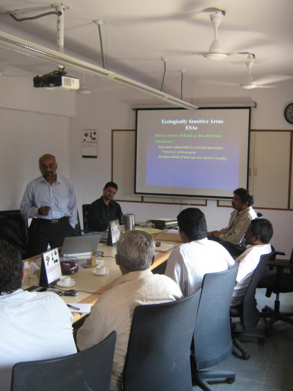
Spatial decision support for conservation planning in the Western Ghats
Summary
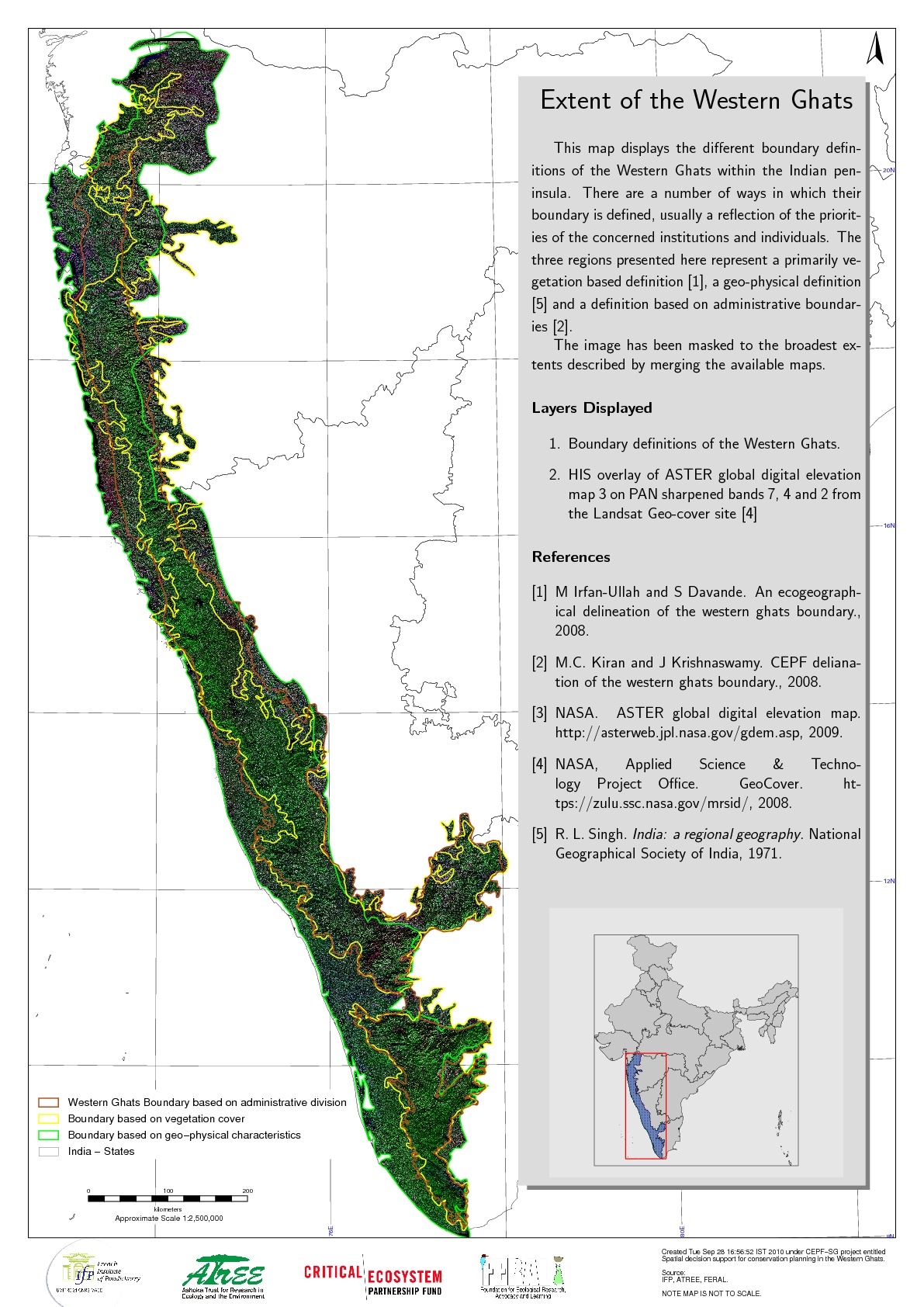
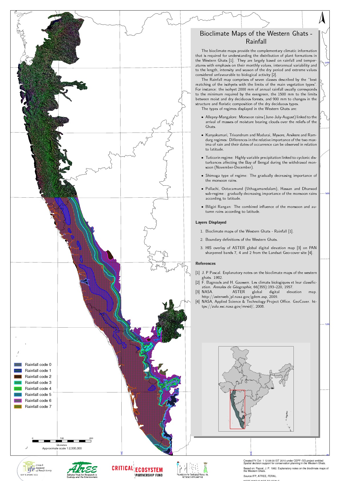
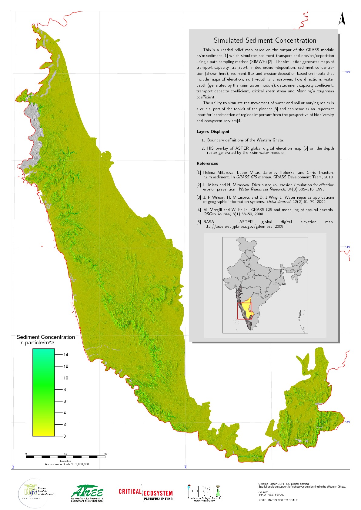
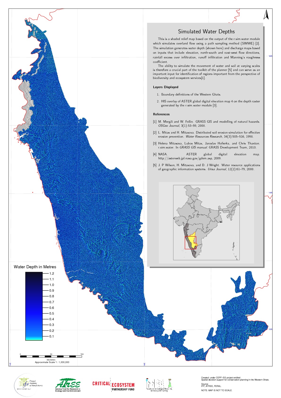
This project seeks to build an open source spatially explicit dataset to help with conservation planning in the Western Ghats. It specifically targets ecologically sensitive areas (ESAs) which have a broad definition which includes: Representative ecosystems with high diversity and richness of native species Systems facing high levels of stress on account of anthropogenic activities Areas where natural ecosystems have been altered beyond their ecological resilience in the recent past and Ecosystems that provide a large set of ecosystem functions and services, largely watershed services.
Objectives
The project involves contributions of data from three institutions (IFP - Pondicherry, ATREE - Bangalore and FERAL - Pondicherry) which will be standardised to fall under the same geographic projection and image or vector format. This collation process will also result in the creation of a detailed metadata about the contributions. Information thus collated will be distributed among the partners and also contributed to the Western Ghats Ecology Experts Panel.
In addition the project intends to pursue original research which helps identify ESAs, to organise three consultations with stakeholders on ESAs and the creation of maps which can be utilised by decision makers in the identification of ESAs and help in conservation planning and decision making.
Status
This project was completed successfully.
The project has met all expectations in terms of results. It has:
1. Collated spatially explicit, geometrically corrected data for the project area.
2. Developed scientifically sound and replicable methodology to identify and evaluate ESAs that combines ecosystem services and biodiversity within a single conceptual frame-work. This is being worked into a scientific publication.
3. Made available maps of ecological sensitivity based on available datasets and covering the entire Western Ghats based on the compiled datasets A presentation of this was made at an international geomatics event and the abstract was published.
4. Identified gaps in baseline data required for identification of ESAs and to guide conservation efforts in the Western Ghats. The gap analysis itself has been completed.
5. Shared digital datasets comprising of this information through the India Biodiversity Portal (http://indiabiodiversity.org/) and interested institutions. Data has been provided to the WGEEP team and to the three partners (IFP, ATREE and FERAL). It has been agreed that all the data will be shared on the CEPF-funded Western Ghats portal (http://thewesternghats.in) pending minor modifications and resolving potential copyright conflicts.
FERAL - once wild, runs wild again.